
Pittsburgh Neighbors in Block Records
Public records around a Pittsburgh address describe parcels, assessment facts, recorded instruments, and selected civic geography. They do not identify every person in each home. Begin with the known property in the County GIS viewer, use its PIN or MBL to retrieve the separate assessment record, and use DRE only for the title chronology. The formal Street or Walking voter-list channel has its own fee, identification, affirmation, and use limits. A Registered Community Organization can help identify the civic area serving a block, but it is not a member roster.
| Block source | What it shows near an address | Access path |
|---|---|---|
| Allegheny County GIS | Adjacent parcel geometry, address, PIN, MBL, and map context | Public viewer and published parcel/address layers |
| County Property Portal | Assessment, tax, building, physical location, and owner or tax mailing fields | Public address/PIN search; added service is documented separately |
| Department of Real Estate | Recorded title parties, document dates, Book/Page, PIN, and legal descriptions | Public index, counter, or documented mail route |
| Street or Walking voter list | Defined statutory voter-list fields on a street | Formal Pennsylvania request for Allegheny County |
| City RCO program | Civic-organization coverage and contact context | City geographic lookup and RCO list |
Assessment and title data must be read separately. Physical Property Location identifies the place. Owner Mailing and Tax Mailing may point elsewhere. A recorded grantor or grantee is a role on an instrument, not proof of current residence. Keep the date and source name with every result.
Mapping a Pittsburgh Neighbor Block
The verified Allegheny block method is manual and parcel-based. The County GIS viewer has address and parcel layers, pan and zoom, drawing, measure, printing, legends, and basemap controls. It does not have a documented native radius or buffer tool. Select surrounding polygons only to orient a small area around the known parcel, then search each selected PIN or address separately in the records that own the fact you need.
- Search the known full address, PIN, or MBL in the Allegheny County GIS viewer.
- Confirm the target parcel and note its PIN or MBL. Turn on the parcel and address layers before examining adjoining polygons.
- Pan or zoom to immediately adjacent parcels, selecting one at a time. Use draw or measure tools only for orientation.
- Enter each selected address or PIN in the County Property Portal and read the dated assessment, tax, and mailing fields separately.
- Use DRE PIN, Book/Page, party, and recorded-date fields only when a title-history question remains. Do not convert any parcel result into a full block roster.
The flow is address to GIS geometry to PIN or MBL to property facts to DRE title chronology. For a question that follows a full named street rather than the immediate parcels, use the Pittsburgh street directory record chain instead. That broader path adds address searching and legal-description work without treating the map as a people search.
Pittsburgh’s Three-System Block Handoff
Allegheny County’s local handoff has a useful limitation: GIS supplies parcel geometry, PIN, and MBL, but its parcel layer has no owner field. The Property Portal supplies physical location, mailing, tax, building, sale, and recording clues, while warning that owner history is incomplete. DRE supplies recorded instruments and the title-party trail. Moving through those three systems preserves what each one can actually prove.
| GIS viewer | Locates the parcel and nearby geometry. Its address-point layer can include number, street components, municipality, ZIP, unit or floor, and parcel ID. |
|---|---|
| Property Portal | Provides the assessment-card context. A Homestead value of YES can reflect a prior owner after a sale or deed change, so it is not a current-occupancy confirmation. |
| DRE land records | Provides grantor, grantee, type, date, document or Book/Page, legal description, and OCR where present. Particular image availability must be checked by record. |
This difference is more than a technical detail. It prevents a map pin from being mistaken for a person. It also prevents an incomplete property history from replacing the recorded chain. County historic documents reach to 1788, but the research does not support a single online-image cutoff for every older document. When an assessment card is needed beyond the portal, the County documents phone, email, fax, and mail request routes.
Note: A PIN is the safest handoff between County systems; a street name by itself can be weak where local road systems are disconnected or repeated.
Pittsburgh Neighbor Geography
Community context follows geography, not an assumed household list. Pittsburgh’s Registered Community Organization program registers qualifying nonprofit organizations that serve defined areas. The City’s Who’s My RCO lookup helps identify the organization connected to a location. It is useful for notices, open meetings, agendas, minutes, and contact context, but City registration does not create a resident or membership directory.
The City’s geographic RCO tool is shown in this RCO lookup capture.
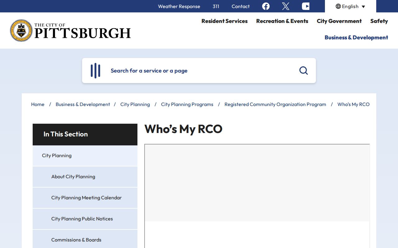
The lookup adds a civic boundary to a parcel search. It does not replace the property portal for parcel facts, DRE for title history, or a direct conversation with a community organization for current participation details. Use its boundary and contact information as local context for a block.
Pittsburgh has 90 neighborhoods, and rivers and hills have produced distinct street systems. Ward, neighborhood, parcel, street address, and postal ZIP are different geography layers. Choose the one used by the record rather than forcing them to match.
Pittsburgh Community Groups in District 7
The City’s District 7 inventory supplies a named, local civic layer for several neighborhoods. It identifies Bloomfield Development Corporation, Bloomfield Citizen’s Council, Baum Centre Initiative, Bloomfield-Garfield Corporation, Bloomfield Livable Streets, Bloomfield Alliance, Friendship Community Group, Highland Park Community Council, Highland Park/East Liberty Bike/Ped Committee, Lawrenceville Corporation, Lawrenceville United, Better Streets Lawrenceville, Morningside Area Community Council, Polish Hill Civic Association, and Stanton Heights Neighborhood Association. These names apply as civic-context leads in the areas identified by the City, not as evidence that a particular person belongs to an organization.
| Official City route | Useful block context | Boundary to keep |
|---|---|---|
| Registered Community Organization program | Qualifying organization coverage, notices, agendas, and open-meeting context | Registration does not make the organization a government agency or a member directory. |
| Who’s My RCO map | Geographic organization lookup for a City location | Use it for coverage and contacts, not for household identification. |
| District 7 organization inventory | Named organizations in Bloomfield, Lawrenceville, Highland Park, Morningside, Polish Hill, and Stanton Heights contexts | Check the City’s current inventory and an organization’s own contact route before relying on a listing. |
The District 7 organizations are shown in this official City inventory capture.
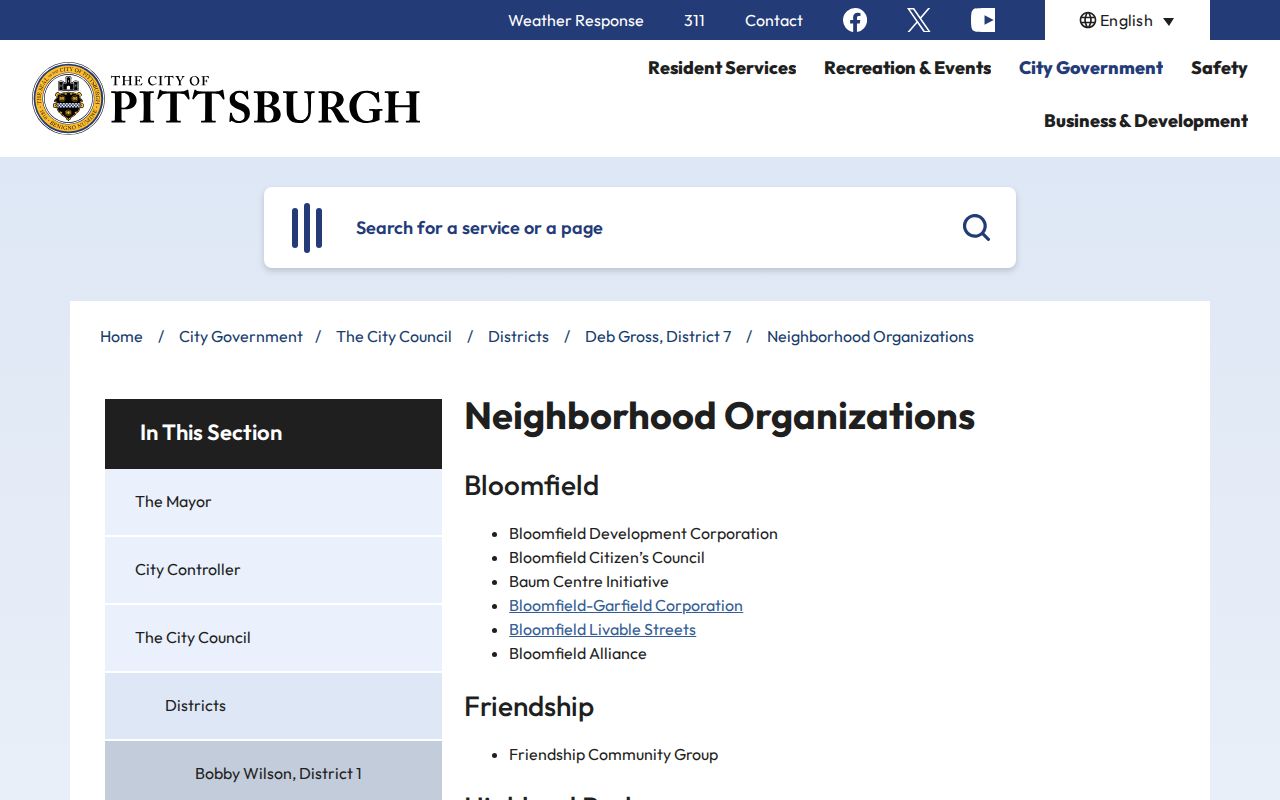
Use an organization’s published contact route or a City RCO lookup for participation questions. Do not infer membership, residence, or ownership from a neighborhood name.
Pittsburgh Street List Access
Pennsylvania treats individual registration status and by-street voter information as different channels. The individual status service is an online, phone, and county-office route, and unattended research did not verify its live form fields. The formal voter-list request form is the researched Street and Walking List path. It requires the selected list type, Allegheny County selection, requester information, identification, a signed affirmation, and the documented $20 fee.
| Official access channel | What it is for | Commercial neighbor tools |
|---|---|---|
| County GIS, Property Portal, and DRE | Parcel, assessment, and title questions with source-specific limits | May combine information, but can be stale, mismatched, incomplete, or unclear about the source date. |
| Formal Street or Walking List | Defined voter-list fields under a signed statutory request | Does not remove the formal access rules, limits, or privacy protections. |
| City RCO maps and inventories | Civic geography and organization context | Cannot verify membership, household composition, or current residence. |
The request form bars Internet publication and restricts use under the cited legal framework. Protected voter categories may use an alternate public mailing address. The form is not a general block-search tool, and the individual registration-status service should not be used as one.
OneStop Context for Pittsburgh Blocks
OneStopPGH Insights can add dated City project context around a Pittsburgh block. Its public map covers planning or zoning applications, construction permits, street permits and plans, code-enforcement cases, and condemned buildings. Address or record number begins the search. Council district, neighborhood, ward, ZIP code, and record type are filters. The Building view can use address, neighborhood, or ZIP with permit number, status, and permit-type limits.
On July 10, 2026, the City announced a public Permit Tracker with application workflow, required and completed inspection history, inspection summaries, and direct downloads for Certificates of Occupancy since June 2019 when a related OneStop record exists. These records date project activity. A named applicant, inspector, supervisor, or license holder is a role in a record, not a current-household finding. The counter at 412 Boulevard of the Allies is another documented access channel.
Pittsburgh Neighbor Lookup Limits
Block research in Pittsburgh has firm privacy limits. Public parcel, assessment, land-record, and civic-map systems do not provide a complete household list. DMV, utility, delivery, and customer records are not County block-directory data. Court files have their own confidentiality rules, and vital records follow separate access law. A missing result means that the relevant custodian, form, counter, or archive route may be needed. It does not prove that a person has no connection to a location.
The Pennsylvania Address Confidentiality Program can provide an alternative mailing address as part of a safety plan for eligible participants. It is not witness protection or a universal removal right for old public sources. State law protects actual address and program records through statutory procedures. Record corrections belong with the City, County, court, election office, or other custodian that created the item.
Note: When an address, mailing field, and title record do not agree, preserve the dates and ask the keeper of the record for clarification.